GeoEditor (akphghaphmokoinaobonplhcaldkfnki): Draw points, polygons and lines on the maps. Collect field data and notes related to a location, attach a photo and fill custom…... Read More > or Download Now >
GeoEditor for Chrome
Tech Specs
- • Type: Browser App
- • Latest Version: 1
- • Price: Freeware
- • Offline: No
- • Developer: https://geoeditor.maptiler.com
User Reviews

- • Rating Average
- 3.67 out of 5
- • Rating Users
- 9
Download Count
- • Total Downloads
- 10
- • Current Version Downloads
- 10
- • Updated: February 15, 2017
GeoEditor is a free Productivity App for Chrome. You could download the latest version crx file and install it.
More About GeoEditor
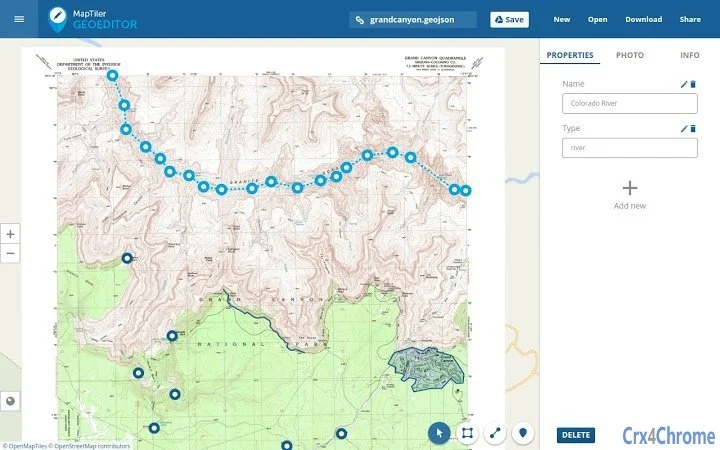
Draw points, polygons and lines on the maps. Collect field data and notes related to a location, attach a photo and fill custom attributes. Drag&drop into the app any GeoJSON, GPX, TopoJSON, etc.
Display your own maps maps generated by MapTiler (http://www.maptiler.com).
The app supports GeoJSON format and synchronization via Google Drive for basic sharing of the data with other people! Perfect for data collection for GIS and surveys.
It is easy to import scanned hiking maps, PDF maps, drone aerial imagery, nautical charts for sailing and navigation with a boat or a yacht, fishing maps, aeronautical charts for flight planning by pilots, parcels and city plans and other opendata from local government. Vector base maps are powered by OSM2VectorTiles. Maps can come from existing tile servers with TileJSON or XYZ tiles.
Supported geodata formats by MapTiler: GeoTIFF, TIFF, JPEG, ECW, SID / MrSID, NOAA KAP / BSB, DEM, OziExplorer OZI OZF2 & OZFX3, WebP, JP2, JPEG2000, GeoJP2, Erdas, Grass, Safe, Sentinel2, SRTM, NASA imagery, USGS map sheets, exports from ESRI ArcGIS, ArcSDE, etc.
The GeoJSON can be converted from / to: ESRI ShapeFile, DXF, DWG, GPX, CSV and KML.
![]()